El Cuartelejo Pueblo Ruins
Site Information
 Location:
Nine-tenths of a mile from the south Scott Lake Park entrance
GPS Coordinates: N 38º 40.611' W 100º54.898'
Intrinsic Qualities:
![]()
![]()
![]()
![]()
Site Logistics:
- The structure is visually accessible and free to the public.
- Handicap accessible concrete walkway
- A parking lot is available
- A vault restroom is located on site
- Covered picnic tables
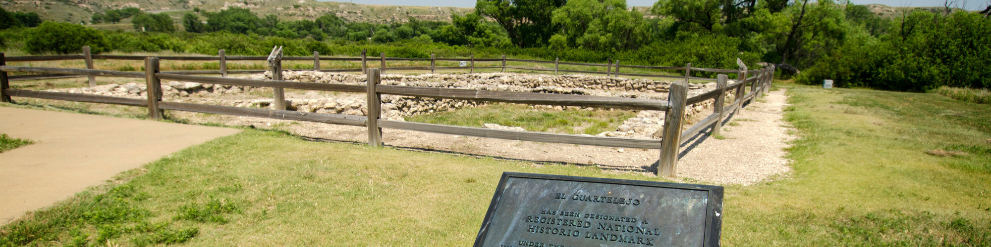
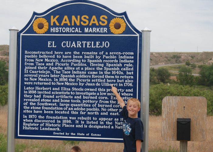
The pueblo, El Quartelejo, was built in the 1600‘s by Taos Indians, and later occupied by members of other nations. El Quartelejo is the only Indian pueblo that has been discovered in Kansas and the northernmost pueblo in North America. A group of Taos Native Americans migrated to the park region, fleeing Spanish rule. They constructed pueblos and cultivated crops using a system of irrigation ditches from a nearby spring. These were the northernmost pueblos constructed in the United States and were inhabited by Indians approximately twenty years before returning to their homes in the south.
El Quartelejo, meaning “old barracks or building,” was later reoccupied in 1701 by a group of Picuris Native Americans who settled the site for two years. The last known reference to the site was in 1727 (after which it was abandoned). The structure deteriorated and disappeared, leaving only a mound and a few irrigation ditches. In the mid-1890s, the ruins were discovered by two professors from the University of Kansas. The present site‘s foundation has been reconstructed.
This archeologically significant site dates from 1650 to 1750 A.D. and is the northernmost pueblo ruin in the United States. The outside walls measured between eighteen and twenty inches thick and surrounded seven different rooms. The interior rooms ranged in size from 10‘ by 14‘ to 16‘ by 18‘. The total pueblo area measures 32‘ by 50‘. No windows or door evidence was found leading experts to classify the dwelling as a pueblo type ruin.
In 1970, Tom Witty of the Kansas State Historical Society re-examined the El Quartelejo site. Twenty sites were found in conjunction with the pueblo, although only one pueblo building was known to have existed. The other sites were either camp areas or storage buildings.
During the excavation, the entire pueblo floor, hearths, and locations of posts were unearthed. The outline of the pueblo walls was found to be different than the 1898 dig. Additionally, the south porch posts were discovered for the first time. Also found was the evidence of an Apache roasting pit under the ruins pre-dating the current pueblo ruins. The walls were stabilized and informational placards were erected.
The D.A.R. (Daughters of the American Revolution), Kansas Chapter, holds the land deed to El Quartelejo. In 1925, the D.A.R. erected a granite marker on the site. It was discovered later that the marker was actually on top of part of the pueblo ruins and the marker was subsequently moved. In 1964, the El Quartelejo Pueblo Ruins was designated as a National Historic Landmark Site.
The Spanish spelling of El Quartelejo is with a “C”, i.e. El Cuartelejo. The English spelling is with a “Q”, i.e. El Quartelejo. This is noted because both spellings are interchangeable at the museum and the park and both spellings are accurate in their identification.